
Geography Awareness Week
& GIS Day
Geography Awareness Week
Geography Awareness Week was started by National Geographic and highlights the importance of geography in understanding our world. Each November, it encourages curiosity about places, cultures, and the connections that shape our lives.

GIS Day
Every November, the Program of Geography & Environmental Resources at Stanislaus State works to contribute on the dissemination of geography knowledge and the importance of geography (spatial reasoning) in other disciplines.
2025 Event Schedule
Check out the exciting events and presentations happening below.
Centering Women: Contemporary Contributions of Female Geographers
Join us to celebrate the powerful voices of women in geography and explore how spatial thinking is transforming communities and disciplines.
Acacia Building 1014
| Time | Program |
|---|---|
| 3:30 PM - 4:00 PM |
Dr. Matthew Derrick Dr. Peggy Hauselt |
| 4:00 PM - 4:15 PM | Charisma Leal | Undergraduate Student at Stanislaus State University, Stockton Campus Experiences of a GIS Intern at the Port of Stockton |
| 4:15 PM - 4:45 PM | Margaret Creighton, GISP-E | GIS Analyst 2, Merced County A GIS Journey Fueled by Questions |
| 4:45 PM - 5:15 PM | Yaniri Piza, B.S. | Planner 1, Merced County Taking a Leap into County Planning |
| 5:15 - 5:30 PM | Closing of the Program |
Library 102
| Time | Program |
|---|---|
| 1:30 - 2:00 PM |
Dr. José Díaz-Garayúa Dr. Peggy Hauselt |
| 2:10 - 2:55 PM | Dr. Rajrani Kalra, Ph.D. | Professor of Geography, CSU San Bernardino Sustainable Urbanism: Making Indian Religious Cities Accessible |
| 3:00 - 3:45 PM | Dr. Julie A. Silva, Ph.D. | Professor of Geography, University of Buffalo (SUNY) Enhancing Survey Sampling in Informal Settlement with Spatial Technologies |
| 3:50 - 4:40 PM | Dr. Xing Gao, Ph.D. MPH | Assistant Professor of Public Health, UC Merced Social and Environmental Determinants of Racialized Inequities in Maternal Health |
| 4:40 - 5:00 PM | Closing of the Program |
Past Event Archive
Browse our past events.
Wednesday, November 13 | Turlock Campus, Library 102
| Time | Program |
|---|---|
| 4:00 PM - 4:15 PM | Dr. José Díaz-Garayúa and Dr. Matthew Derrick Welcome to the Program |
| 4:15 PM - 4:45 PM | Dr. David Chambers, Ph.D. | Merced Community College Walking like a Hmong Person: Ethnic Identity in the Moment of Rupture. |
| 4:45 PM - 5:15 PM | Marcelo S.R. Da Silva, ABD | Modesto Junior College Climate Justice in the Americas. |
| 5:15 PM - 5:45 PM | Dr. Goshu W. Tefera, Ph.D. | Stanislaus State University The Intersection of Time and Space in Environmental Justice. |
| 5:45 PM - 6:00 PM | Q & A |
| 6:00 PM - 6:45 PM | Dr. Luis Sánchez-Ayala, Ph.D. | Universidad de Los Andes (Colombia) Territories of Resistance: A Strategy Against Marginalization |
| 6:45 PM - 7:15 PM | Q & A / Closing |
Monday, November 18 | Stockton Campus, Acacia Building, Room 1014
| Time | Program |
|---|---|
| 5:00 - 5:15 PM | Dr. José Díaz-Garayúa and Dr. Matthew Derrick Welcome to the Program |
| 5:15 - 5:45 PM | Amanda Martínez Leung, B.S. | San Joaquin County Using GIS in the Assessor's Office: More than just Assessment Data |
| 5:45 - 6:15 PM | Gene Barrera, MCP | Merced County Innovations in GIS for Social Services at Merced County: A Strategic Planning Approach |
| 6:15 - 6:30 PM | Q & A |
| 6:30 - 8:15 PM | Students Presentations |
| 8:15 - 8:30 PM | Closing |
Tuesday, November 7
Location: Stockton Campus - Free Parking
Unfortunately, due to technical problems, all videos were lost with exception of one. Please look the hyperlink of "Geographies of Nationalism" by Dr. David H. Kaplan.
| Time | Program |
|---|---|
| 2:00 PM - 2:20 PM (Stockton 1116) | Christina Falk, M.S. | GIS/IT Coordinator, San Joaquin County Buzz, Bites, and Public Health Insights: A GIS Approach to Mosquito Control. |
| 2:20 PM - 2:40 PM (Stockton 1116) | Adam Fleenor, Ph.D. | Stanislaus State, Sociology Native American GIS Counter-Maps: Social Justice and the Power of Maps |
| 2:40 PM - 3:00 PM (Stockton 1116) | Q & A |
| 3:00 PM - 4:00 PM (Stockton 1066) | Alison McNally, Ph.D. | Stanislaus State, Geography & Environmental Resources Workshop: How to build a Dashboard |
Wednesday, November 8
Location: Turlock Campus, Vasché Library - Free Parking in Lot #2 (excepting reserved for Faculty, Staff, and others)
| Time | Program |
|---|---|
| 3:30 PM - 4:00 PM (Library 102) | Matthew Derrick, Ph.D. | Interim Associate Dean, Stockton Campus Some Thoughts on Russia Today: Geographic Dimensions |
| 4:00 PM - 4:20 PM (Library 102) | Marcelo S.R. da Silva, Ph.D. Candidate | UC Merced Settler Colonialism in the Brazilian Amazon? |
| 4:20 PM - 4:40 PM (Library 102) | Kenneth Boettcher, M.A. | Stanislaus State, History How Neoliberal Capitalism Fuels the Climate Crisis and Rising Fascism |
| 4:40 PM - 5:00 PM (Library 102) | Q & A |
| 5:00 PM - 5:20 PM (Library 102) |
Elissa LaComb, B.S. | Alumna working at the Forest Service |
| 5:20 PM - 5:40 PM (Library 102) | Gene Barrera, M.C.P. | GIS Manager, Merced County A Regional Approach to GIS Governance: The North Valley THRIVE Project |
| 5:40 PM - 6:00 PM (Library 102) | Q & A |
| 6:00 PM - 7:00 PM (Library 201) | Laura Plascencia, B.S. | Valley Improvements Projects (VIP) Workshop: Visualizing Equity Indicators within the Central Valley using CalEnviroScreen 4.0: California's Environmental Health Mapping Tool (L 201) |
Thursday, November 9
Location: Turlock Campus, Vasché Library - Free Parking in Lot #2 (excepting reserved for Faculty, Staff, and others)
| Time | Program |
|---|---|
| 2:30 PM - 3:00 PM (Library 102) | Goshu Tefera, Ph.D. | Stanislaus State, Ethnic Studies Interpretivist Geography: Studying Immigrants and Ethnic Minorities |
| 3:00 PM - 3:20 PM (Library 102) | Mirta Maldonano Valentín, Ph.D. | Stanislaus State, English Multilingualism and Cultural Representation in Livingston, CA: A Sociolinguistic Study on Identity Formation in a Diverse Linguistic Landscape |
| 3:20PM - 3:40 PM (Library 102) | Covadonga Lamar Prieto, Ph.D. | UC Riverside, Associate dean of CHASS Geography and Minoritized Languages in California |
| 3:40 PM - 4:00 PM (Library 102) | Q & A |
| 4:00 PM - 5:00 PM (to be announced) | Esteban Montenegro, Ph.D. | Stanislaus State, Psychology Workshop: Gentle Introduction to R Programming |
| 5:00 PM - 5:30 PM (Library 102) | David H. Kaplan, Ph.D. | Kent State University, Geography Geographies of Nationalism |
|
6:00 PM - 7:00 PM (Art Gallery) |
Sarah Grew, B.A. | Photographer & Painter Reception, Artist Talk & Exhibition: Ghost Forest & Plankton Line-Up |
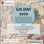
This year CASA | Center for Applied Spatial Analysis and the Geography Program bring the Geography Awareness Week & GIS Day with three independent one-hour programs:
Monday, November 15, 2021 | 2:00PM to 3:00 PM (Pacific Time) | Language & the Right to Public Space with Dr. Carr
Wednesday, November 17, 2021 | 1:00PM to 2:00PM (Pacific Time) | GIS Professionals Experiences: A Panel with Mr. Eugene Barrera, Mr. Aron Harris, Mrs. Kelechenyi, and Mrs. Lopez
Friday, November 19, 2021 | 1:00PM to 2:00PM (Pacific Time) | Thinking Geographically: Making "Known" Research Problems Unique with Dr. Sánchez-Rivera
Too many young Americans are unable to make effective decisions, understand geo-spatial issues, or even recognize their impacts as global citizens. National Geographic created Geography Awareness Week to raise awareness to this dangerous deficiency in American education and excite people about geography as both a discipline and as a part of everyday life. Follow along on #GeoWeek
GIS Day is an annual event celebrating the technology of geographic information systems (GIS) that was initiated by spatial analytics world-leader Esri, and which first took place in 1999. Follow along on #GISDay
This year, we bring three (3) online one-hour presentations
Language & the Right to Public Space
MONDAY, NOVEMBER 15, 2021 FROM 2:00 PM to 3:00 PM (Pacific Time)

Language can act as a barrier to social engagement, and individuals who do not speak or read the language being used are inhibited from participating in public activities. In this presentation, Dr. Carr will discuss the accessibility of Southeast Los Angeles’ linguistic landscape, or the written language displayed in public space, considering over 4,500 signs and 24 interviews with residents of Spanish-speaking neighborhoods. Results show that the lack of Spanish in signage can negatively impact Latinx individuals’ sense of belonging in their communities and their right to participation in the public space. (VIDEO with subtitles in Spanish | VIDEO with subtitles in English)
Jhonni Carr holds a PhD in Hispanic Linguistics from the University of California, Los Angeles. She currently teaches in the Department of Spanish & Portuguese at the University of California, Berkeley. Specializing in Spanish Sociolinguistics, she investigates the power dynamics of displayed languages in the public space of Southern California and Mexico.
GIS Professionals' Experiences
WEDNESDAY, NOVEMBER 17, 2021 FROM 1:00 PM to 2:00 PM (Pacific Time)
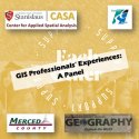
This panel provides a short yet important actualization on the importance of GIS in local government. Mr. Barrera highlights his work creating a pipeline from Stanislaus State and the County of Merced to provide “real world” experiences in the application of GIS in local government. Mr. Harris will talk about desires skills to develop resourceful GIS professionals for the public or private sector. Mrs. Kelechenyi introduces her most recent work with the Merced County Courthouse Museum while Mrs. Lopez bring her experiences as an intern at Stanislaus County.
Thinking Geographically
FRIDAY, NOVEMBER 19, 2021 FROM 1:00 PM to 2:00 PM (Pacific Time)

“Geography is everywhere” (Cosgrove, 1989), but despite the valuable insights that geography offers to research and every-day problems, the general population widely misunderstand the discipline, and its importance is often overlooked. Through the story of her academic journey, Thinking Geographically: Making “known” Research Problems Unique, (VIDEO with subtitles in Spanish | VIDEO with subtitles in English) studying racial, ethnic and national identity in Dr. Sanchez-Rivera reflects on how known-research problems and theories could benefit from the geographic perspective and its refreshing approaches.
Dr. Ana Sánchez-Rivera is a Human Geographer with a Cognitive and Social Psychology background. Her undergraduate research at the University of Puerto Rico was based on discriminatory attitudes against Dominicans living in Puerto Rico. She completed her MA in Multicultural Geography at SUNY Binghamton. Her thesis expanded on how Whitening’s patterns changed by places in the Island and the importance of these when identifying xenophobic attitudes against Dominicans. She recently completed her Ph.D. at the University of Maryland, Geography Department. Her work contributed to Identity Process Theory and its position about people-place relationships. Her study focused explicitly on how places created by the government and, the narratives told about them, influence racial, ethnic and national identity in Puerto Rico. Dr. Sanchez-Rivera currently works as Survey Statistician for the Racial Statistics Branch, at the US Census Bureau, Population Division.
This 1-hour online activity, supported by CASA | Center for Applied Spatial Analysis, brings a conversation with David and Sharon Froba about Racially Restrictive Covenants in Modesto. These Racially Restrictives Covenants were used across the United States and Modesto was not an exception. These records show how RRCs were used in Modesto mainly around the 1930s, 1940s, and 1950s. Although these restrictions are not applicable nowadays, their effects continue haunting the deepest fabric of our society.
GIS stands for Geographic Information Systems. The GIS Day takes place during the middle of the Geography Awareness Week. The GIS Day is and annual and worldwide event celebrated for the first time in 1999 by the National Geographic Society, the American Association of Geographers, and the Environmental System Research Institute (ESRI), which is the developer of the ArcGIS Pro, a GIS software widely use.
Reviewing the Urban Historical Geography of Racially Restrictive Covenants (RRCs) it is important. After the Great Depression prompted the National Mortgage Crisis of the 1930s, legislation from the New Deal provided a shift on mortgage lending. The Federal Government backed mortgage lending not just as a path to increase homeownership but also wealth accumulation. However, not everybody was treated equally. Non-white communities were redlined and housing developments and housing deeds on those developments started to add Racially Restrictive Covenants with a similar language to this:
“H) That said lots, or any portion thereof, shall not be used in any manner whatsoever or occupied by any Negro, Chinese, Japanese, Hindu, Malayan, Mexican, Cuban, or native of the Turkish Empire, or any person not of the Caucasian race, or descent thereof except as the servant of the occupant.”
These Racially Restrictives Covenants were used across the United States and Modesto was not an exception. These records show how RRCs were used in Modesto mainly around the 1930s, 1940s, and 1950s. Although these restrictions are not applicable nowadays, their effects continue haunting the deepest fabric of our society.
Presentation: Racially Restrictive Covenants in Modesto, California
& the use of GIS
For Closed Captions in English or Spanish click on CC available at the bottom right in your selected video.
Presentation with closed captions in English
Presentación con subtítulos en español
Speakers

Sharon Froba | Sharon Froba founded Modesto High School’s annual Day of Respect in 1998. Day of Respect has been featured on Inside California Education, a show on PBS, KVIE Channel 6, and the Modesto Bee. As a retired teacher, Sharon has continued working for our community. Sharon and David took on the painstakingly difficult task of collecting and identifying documents from the Stanislaus County archives on Racially Restrictive Covenants in Modesto.
Go to the web mapping application
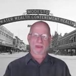
David Froba, JD | As a retired attorney at law, David Froba has helped uncover over one hundred subdivisions, and counting, with racially restrictive covenants (RRC's) In Modesto. RRC's were used as a legal tool to segregate many cities across the United States, and Modesto was no exception. These records show how RRCs were used in Modesto mainly around the 1930s, 1940s, and 1950s.
Moderators

Mr. Cameron Pallotta, M.S. | is lecturer in the Geography Program and the Geography GIS computer lab manager at California State University, Stanislaus. Mr. Pallotta has helped us with several key components during this process.
Get to know more about Cameron's work
José R. Díaz-Garayúa, Ph.D. | He is Associate Professor of Human Geography and Geographic Information Systems (GIS) at California State University Stanislaus. He is co-Director of CASA, the Center for Applied Spatial Analysis. His research focuses on inequities with emphasis on race, ethnicity, and place. One of his interests spin around the intersection of Geography (Geographic Thought, Spatial Thinking, and GIS) and the Humanities (particularly the human experience and cultural studies).
This program was made possible with the support from:
This event, with support from California Humanities, brought a series of speakers during the 2019 Geography Awareness Week, specifically during the GIS Day, who shared their work on how geography meets the humanities, having social justice as a central theme. Speakers talked about a wide range of topics including film, fair trade, the role of GIS in activism and social justice in disadvantaged communities, and health and inequalities among others. The public had the opportunity to learn and ask questions and reflect on the importance of the humanities and geography.
Updated: October 27, 2025